by Gary Stanyard
Brunei has its wonder and rugged beauty and let me tell you, the hiking trails here are enough to make some local legends. In recent years, many locals have caught on to the thrill of hitting the trails, and new paths are popping up. The existing trails aren’t too shabby either, with better signage and upkeep than ever before.
I’m here to guide you through the best of the best in which you are walking in sight of some of the oldest rainforest systems in the world – five great hikes in the sultanate that will provide a feast for the eyes and get the heart pumping. Forget about counting your steps, walking is a meditation, relax into it and go!
BUKIT BATU BUJANG PAHANG
DIFFICULTY: Moderate TIME: 60 – 120 minutes DISTANCE: 3 – 9 KM ELEVATION GAIN: 215 Metres
STARTING POINT: Take a boat to Pulau Berambang jetty ( BND 1 from Jalan Residency)
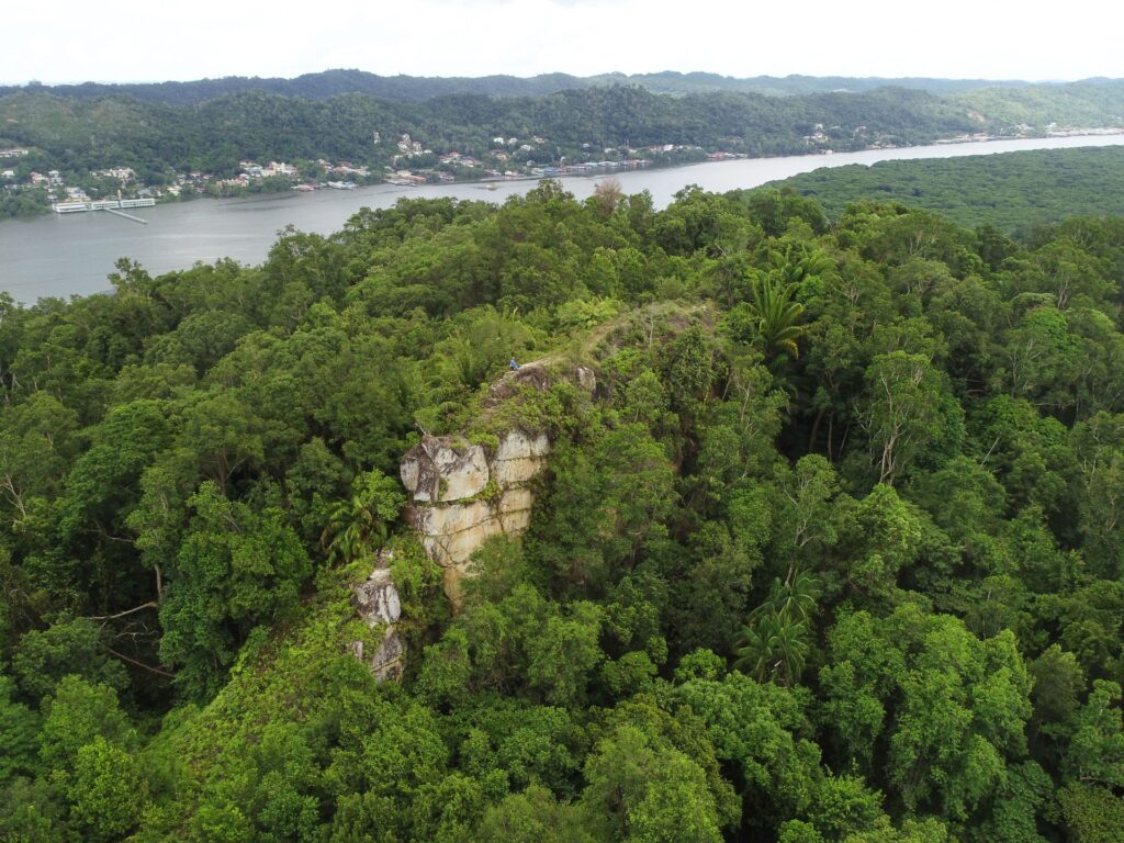
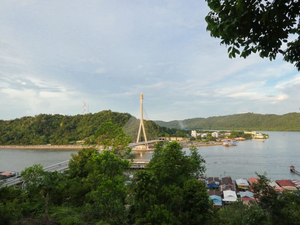
Now this is a good one. It takes effort to get there, effort to begin. Take a boat out from the Yayasan Complex or RIPAS bridge jetties. Pulau Berambang jetty is about two kilometres away, but the trail head is a further three kilometres from there. The smart move is to bring a bicycle on the boat and ride to the trailhead. You can lock it up next to the Sepak Takraw court, near the trailhead sign. The climb is steep at first but the path is clear and shaded. You’ll find a path to an old coal mine on the way, but if you’re looking for the real prize, stay right and push to the top where you’ll find a rocky outcrop with panoramic views of Brunei Bay, SOAS bridge and the Limband River below. Just remember, bring your own water — there are no refreshments on the way. If you time it right, you can catch a rewarding sunset view on the boat ride back to the city.
BUKIT SIPATIR
DIFFICULTY: Easy – Moderate TIME: 60 – 90 minutes DISTANCE: 3 – 4.5 KM ELEVATION GAIN: 191 Metres
STARTING POINT: Spg 322, Jalan Subok, Bandar Seri Begawan.
Sipatir, my hiking friends, is a fine vantage point. From the top, you’ll get a bird’s eye view of the Brunei River, Brunei Bay, and even a glimpse of Malaysia. But be warned, it’s a popular spot for the masses, with wide, beaten paths suitable for keen trail runners. It’s no cakewalk, though — the ascent will get your heart pumping, but there’s plenty of pit stops to catch your breath and take in the view. A few refreshments await at the trailhead, and along the way you’ll find a few honesty boxes stocks with cold tins for a moderate dollar.
SUNGAI LIANG RECREATIONAL PARK
DIFFICULTY: Moderate TIME: 90 minutes DISTANCE: 4 KM ELEVATION GAIN: 157 Metres
STARTING POINT: Taman Rekreasi Hutan Sungai Liang, Jalan Labi, Kuala Belait
Belait district’s favourite hiking spot starts and finishes in Brunei’s first national park. If you’re parking here, remember the park gates close at 6 PM. Take the steps to the right, this will take you on a trail through the Dipterocarp trees and bring you out to a sealed road. Turn left and head 500 metres towards a pondok, next to one of a few mountain bike jumps and follow the path, keeping left until arriving at your first T-junction. Now you’re ready to climb! Head straight down and straight on up to Bukit Kubu. There’s a little share in this part, so make sure you bring a hat. The trails are reasonably easy to spot, and popular, mostly following the route under the electricity pylon, which perch atop the hills. The hike will lead you down alongside Jalan Tengah and the fertiliser plant, before turning right and following the electricity pylons back up into the shade of the forest and the sealed road. This trail is a favourite among hikers, so if you’re lost, someone will usually be nearby. If you’re heading deeper in and off the hiking trail, you may encounter some mountain bikers on some well used bike paths.
BUKIT PATOI
DIFFICULTY: Moderate – Difficult TIME: 100 – 120 minutes DISTANCE: 3.8 KM ELEVATION GAIN: u284 Metres
STARTING POINT: Bukit Patoi Recreational Park, Labu, Temburong
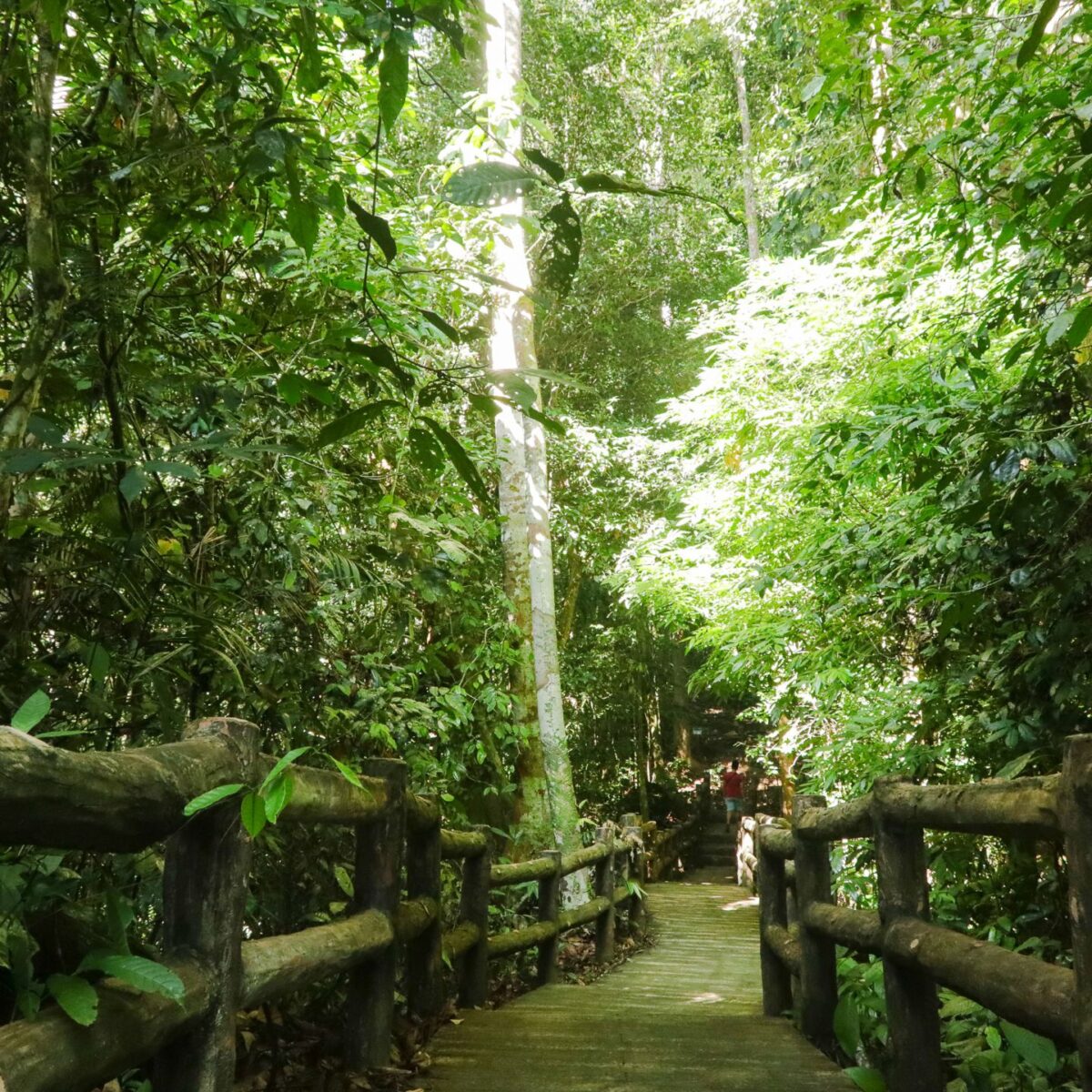
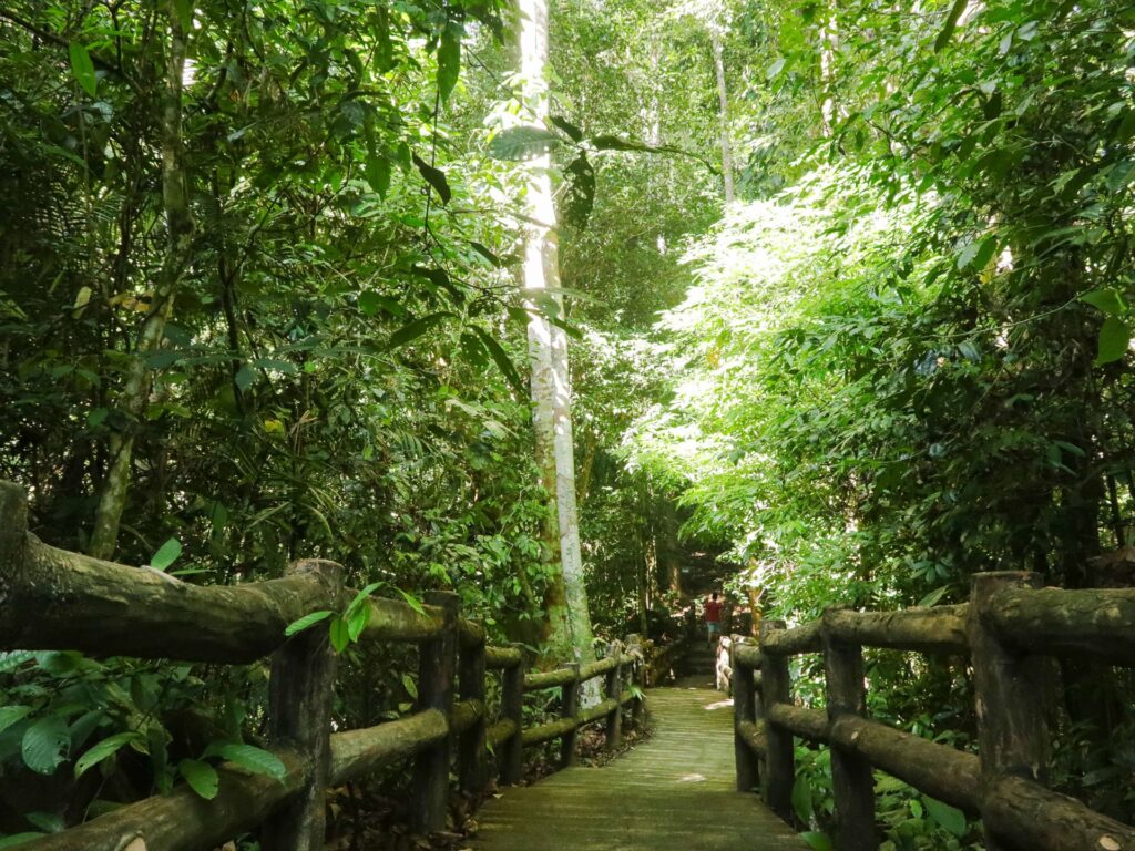
The jungle in Temburong just hits differently: it’s fresh, it’s huge, it’s primaeval. I’ll tell you this, you feel like you’re walking in the footsteps of your ancestors here. You’ll get a sense of this on the trail to Bukit Patoi, no more so than when you are standing by the largest standing wall of rock, Batu Berdinding, wondering who has been there before you. The Bukit Patoi trail is a straight forwards lollipop — follow the rope leads and arrows for interesting rock formations and plenty of indication there’s wildlife along the way. Without appropriate footwear, you’ll righty find it harder to keep your footing on the many parts that are green and mossy underfoot. At the peak, you are rewarded with a view of the jungle around Trusan, Sarawak; with shady spots to park the car at the entrance and path maintenance by the local rangers, this is a great hike to challenge yourself.
BUKIT MERIKAN
DIFFICULTY: Moderate – Difficult TIME: 45 minutes DISTANCE: 2.4 KM ELEVATION GAIN: 112 Metres
STARTING POINT: Next to Perdana Wangsa Haji Mohammad Mosque
Haven’t got time for a long hike? Do this three-hill loop! One of the many hikes that was reinvigorated by locals clearing paths and making signs to get active around Kampong Lumapas. You’ll hit three small hills on this hike and it’s pretty steep — slippery in places — but for a veteran of ready about hiking, you’ll manage. There’s three good lookouts over RIPAS bridge and Kampong Ayer, but you’re a trail runner now and there’s no shade, so you’ll need to keep moving. Park near the mosque on Jalan Tarap Bau, do up your laces, stay hydrated and get at it. For a reward at the end, add a short walk to a gerai on the boardwalks of Kampong Ayer — there’s good Soto to be found!